Easter Island
Attractions
Archaeological
Museums and Art Galleries
Tours
Culture & History Tours
Theme Tours
Nature & Adventure Tours
Things To Do
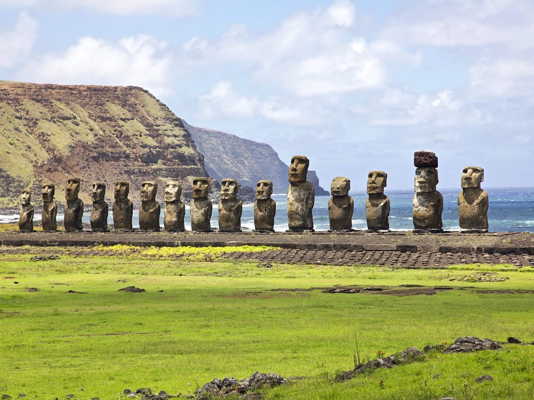
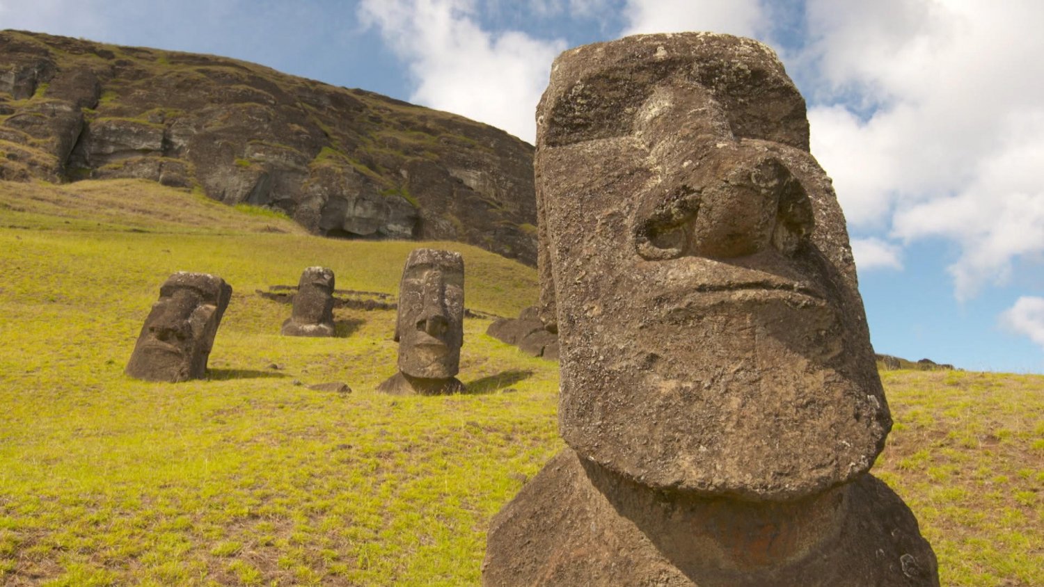
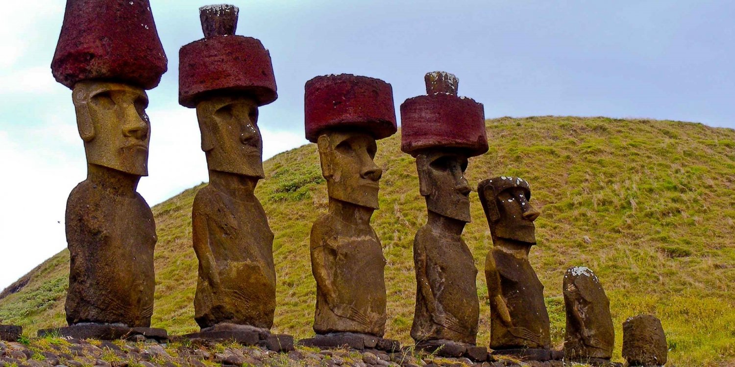
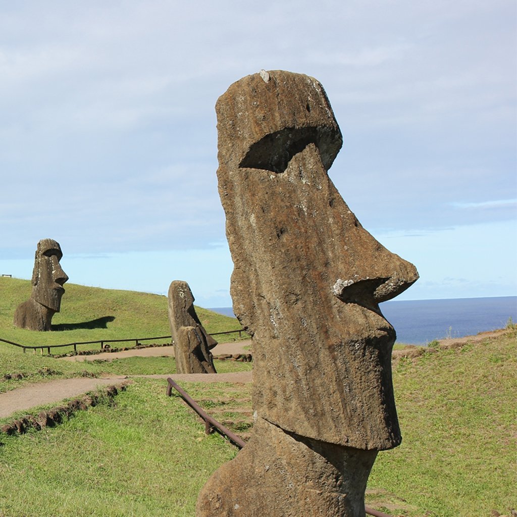
Easter Island, Spanish Isla de Pascua, also called Rapa Nui, Chilean dependency in the eastern Pacific Ocean. It is the easternmost outpost of the Polynesian island world. It is famous for its giant stone statues. The island stands in isolation 1,200 miles (1,900 kilometres) east of Pitcairn Island and 2,200 miles west of Chile. Forming a triangle 14 miles long by seven miles wide, it has an area of 63 square miles (163 square kilometres); its highest point, Mount Terevaka, is 1,969 feet (600 metres) above sea level.
To its original inhabitants the island is known as Rapa Nui (“Great Rapa”) or Te Pito te Henua (“Navel of the World”). The first European visitors, the Dutch, named it Paaseiland (“Easter Island”) in memory of their own day of arrival. Its mixed population is predominantly of Polynesian descent; almost all live in the village of Hanga Roa on the sheltered west coast. Pop. (2002) 3,304; (2017) 7,750.

Easter Island Heads
Relief
The small and hilly island is not part of a sunken landmass but is a typical oceanic high island formed by volcanoes rising from the seafloor. Geologic and oceanographic evidence shows that no perceptible emergence or submergence of the island’s coastline has taken place since the last fall in sea level, which occurred less than 10,000 years ago. Three extinct volcanoes chiefly composed of tuff (a porous rock formed of compacted volcanic fragments) and joined by their own lava flows give the island its characteristic triangular shape. Parasitic tuff craters and cones (i.e., craters and cones formed on the side of, or near, volcanoes after the original vent has become plugged up) are interspersed in the landscape, which is otherwise dominated by eroded lava fields in which obsidian is commonly found.
Most of these fields are thickly packed with both large and small lumps of cellular and tuffaceous lava that is either black or rusty in colour. Stoneless surface soil is sparse; it is suitable for extensive cultivation mainly in the Hanga Roa and Mataveri area in the southwest, at Vaihu and on the plain southwest of the volcano Rano Raraku, and on the prehistorically cleared Poike peninsula in the eastern corner of the island. Rain collects in the partly bog-covered crater lakes of the volcanoes Rano Kao, Rano Raraku, and Rano Aroi. One intermittent stream, fed by the Rano Aroi crater lake, flows down Mount Terevaka’s slopes before disappearing into the porous soil. Water from the extremely deep crater of Rano Kao, which is about 3,000 feet wide, is piped to Hanga Roa. The coast is formed by soft, eroded, ashy cliffs, with a vertical drop of about 500 to 1,000 feet; the cliffs are intercepted by long stretches of low, hard, and rugged lava formations.
There is no natural harbour, but anchorage is found off Hanga Roa on the west coast; off Vinapu and Hotu-Iti on the south coast; and off Anakena and in the Bahía la Perouse on the north coast. Notable among the few small offshore islets are Motu-Nui, Motu-Iti, and Motu-Kaokao (which figured in a local bird cult) near the southwest cape. The only true sand beach is at Anakena; most other beaches are of gravel. Caves abound, many consisting of subterranean rooms joined by narrow tunnels extending far into the lava beds.
To its original inhabitants the island is known as Rapa Nui (“Great Rapa”) or Te Pito te Henua (“Navel of the World”). The first European visitors, the Dutch, named it Paaseiland (“Easter Island”) in memory of their own day of arrival. Its mixed population is predominantly of Polynesian descent; almost all live in the village of Hanga Roa on the sheltered west coast. Pop. (2002) 3,304; (2017) 7,750.
Easter Island Heads
Relief
The small and hilly island is not part of a sunken landmass but is a typical oceanic high island formed by volcanoes rising from the seafloor. Geologic and oceanographic evidence shows that no perceptible emergence or submergence of the island’s coastline has taken place since the last fall in sea level, which occurred less than 10,000 years ago. Three extinct volcanoes chiefly composed of tuff (a porous rock formed of compacted volcanic fragments) and joined by their own lava flows give the island its characteristic triangular shape. Parasitic tuff craters and cones (i.e., craters and cones formed on the side of, or near, volcanoes after the original vent has become plugged up) are interspersed in the landscape, which is otherwise dominated by eroded lava fields in which obsidian is commonly found.
Most of these fields are thickly packed with both large and small lumps of cellular and tuffaceous lava that is either black or rusty in colour. Stoneless surface soil is sparse; it is suitable for extensive cultivation mainly in the Hanga Roa and Mataveri area in the southwest, at Vaihu and on the plain southwest of the volcano Rano Raraku, and on the prehistorically cleared Poike peninsula in the eastern corner of the island. Rain collects in the partly bog-covered crater lakes of the volcanoes Rano Kao, Rano Raraku, and Rano Aroi. One intermittent stream, fed by the Rano Aroi crater lake, flows down Mount Terevaka’s slopes before disappearing into the porous soil. Water from the extremely deep crater of Rano Kao, which is about 3,000 feet wide, is piped to Hanga Roa. The coast is formed by soft, eroded, ashy cliffs, with a vertical drop of about 500 to 1,000 feet; the cliffs are intercepted by long stretches of low, hard, and rugged lava formations.
There is no natural harbour, but anchorage is found off Hanga Roa on the west coast; off Vinapu and Hotu-Iti on the south coast; and off Anakena and in the Bahía la Perouse on the north coast. Notable among the few small offshore islets are Motu-Nui, Motu-Iti, and Motu-Kaokao (which figured in a local bird cult) near the southwest cape. The only true sand beach is at Anakena; most other beaches are of gravel. Caves abound, many consisting of subterranean rooms joined by narrow tunnels extending far into the lava beds.